Before the LA riots; before the internment of Japanese-Americans and the massacre of Chinese-Americans; before Slavery; before this land was ever conquered by Spain, Mexico, or the U. S.; before the genocide of Native Americans… millennia after the first humans arrived on the scene, overkilling large mammals to extinction… by the river, within the community of Yang-Na, a sapling sprouted. The sycamore would grow to become a 400-year-old local landmark, called, "El Aliso." Here, a French cooper hybridized the mission grapevine with cuttings from Bordeaux, and together with the terroir, cultivated a vineyard which gave birth to California's wine industry. Indigenous villages and immigrant orchards prepared the ground for what followed: a German brewery; a boxing arena; a mule market; an Edison Electric power station; an artist colony; a gym for indoor rock-climbing; the largest railroad passenger terminal in the Western United States… While the Aliso Tree is no longer standing, it continues to stand for Los Angeles, rooted in history.
MAPS OF EAST LOS ANGELES: PROPERTY CHANGING HANDS FROM VIGNES TO MOULTON — 1854-1891
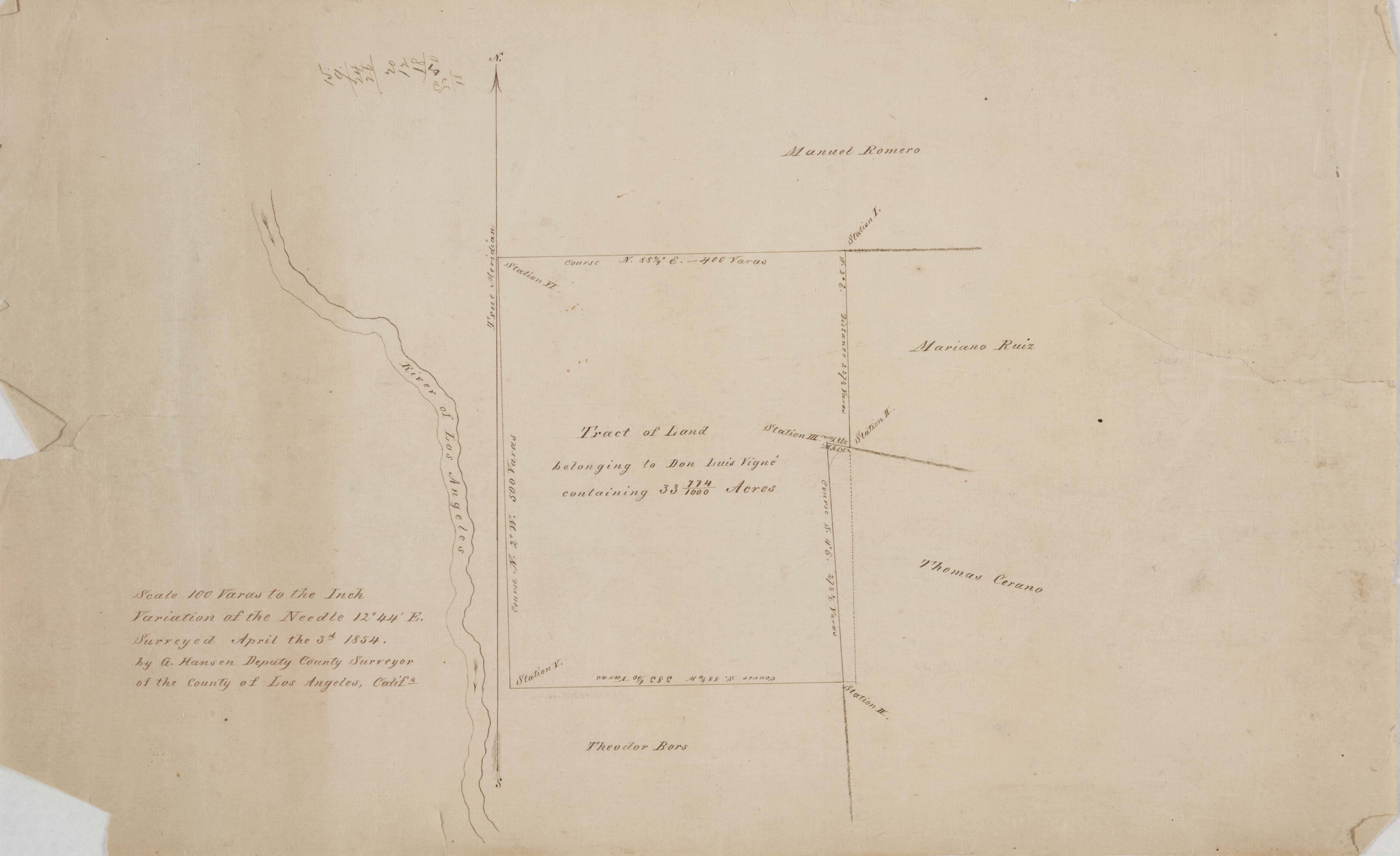
Tract of land belonging to Don Luis Vigné: East of Los Angeles River — 1854
-Image courtesy of the Huntington Digital Library, Solano-Reeves collection, “Tract of land belonging to Don Luis Vigné: East of Los Angeles River. Parcel owners indicated along with stations and bearings; shows Los Angeles River to the west of the tract,” by George Hansen, April 3, 1854
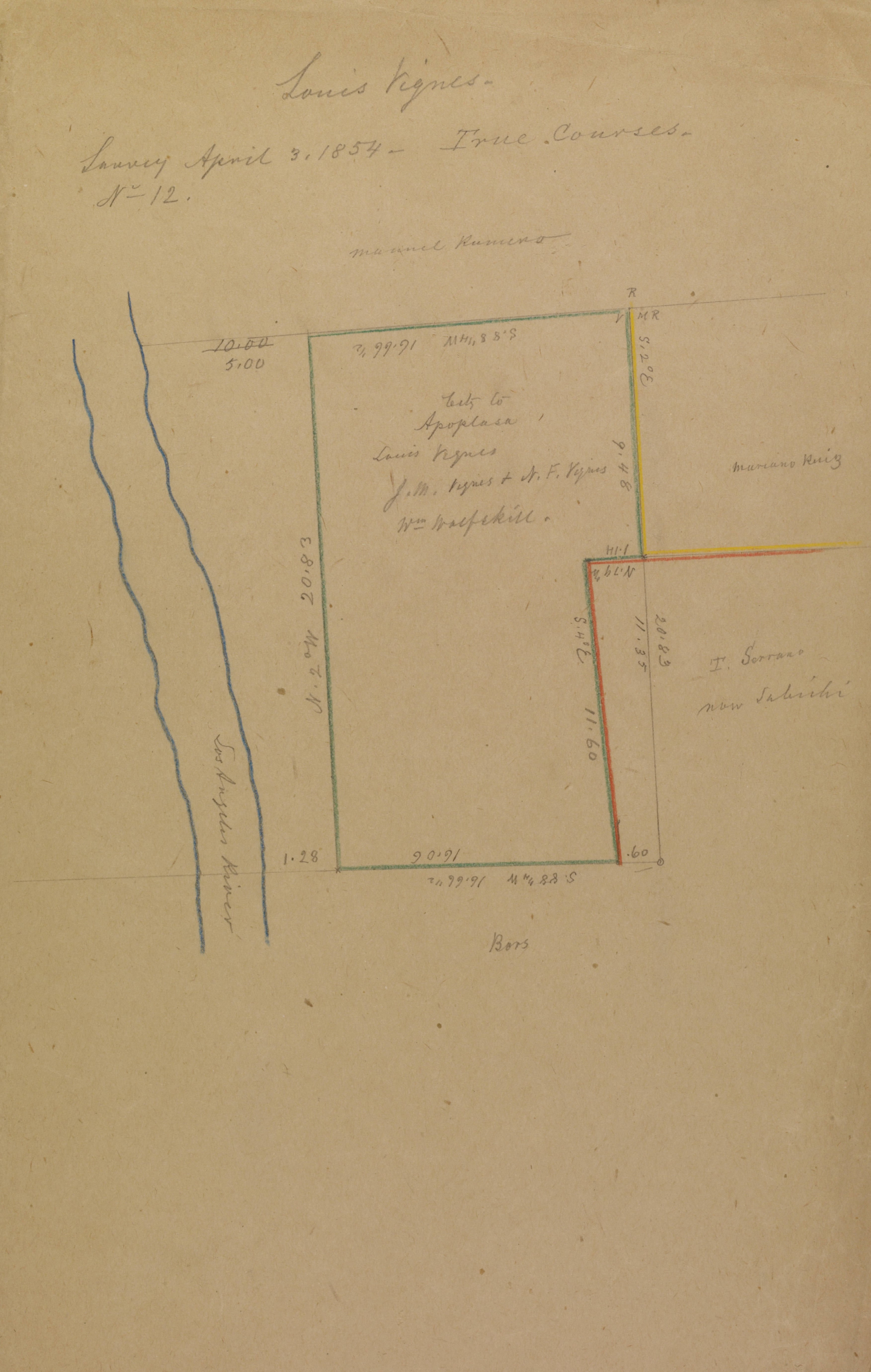
Vignes, Jean Louis: parcel east of Los Angeles River — 1854
-Image courtesy of the Huntington Digital Library, Solano-Reeves collection, “Vignes, Jean Louis: parcel east of Los Angeles River,” by April 3, 1854
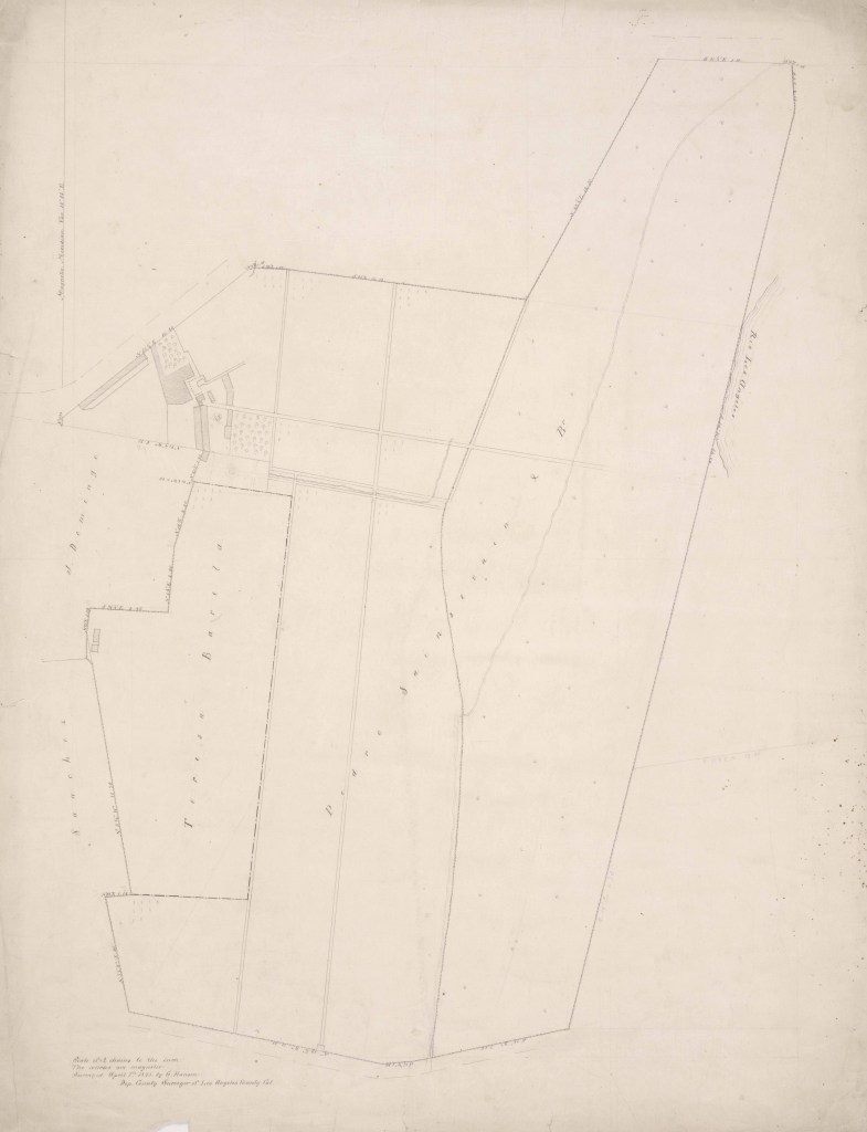
Vigné Vineyard sold to Barela and Sainsevain; between San Pedro road and Los Angeles River; structures, surface detail — 1855
-Image courtesy of the Huntington Digital Library, Solano-Reeve collection, “Vigné Vineyard sold to Barela and Sainsevain; between San Pedro road and Los Angeles River; structures, surface detail; bearings,” by George Hansen, April 7, 1855
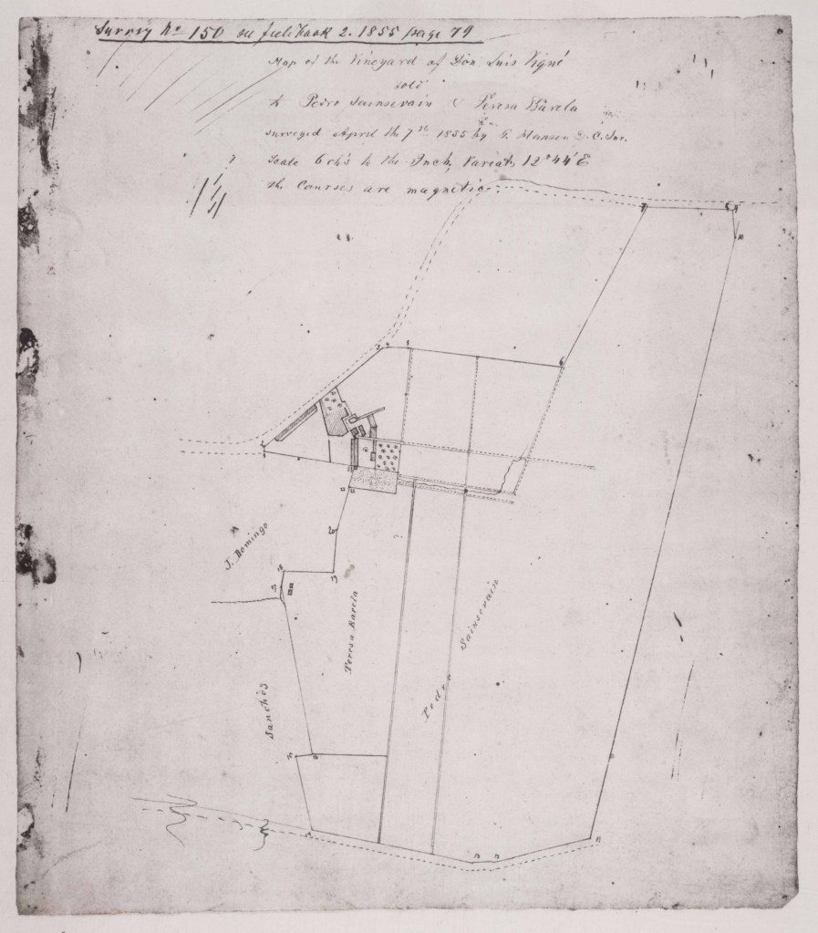
Map of the Vineyard of Don Luis Vigné sold to Pedro Sainsevain and Teresa Barela — 1855
-Image courtesy of the Huntington Digital Library, Solano-Reeves collection, “Map of the Vineyard of Don Luis Vigné sold to Pedro Sainsevain and Teresa Barela,” by George Hansen, undated
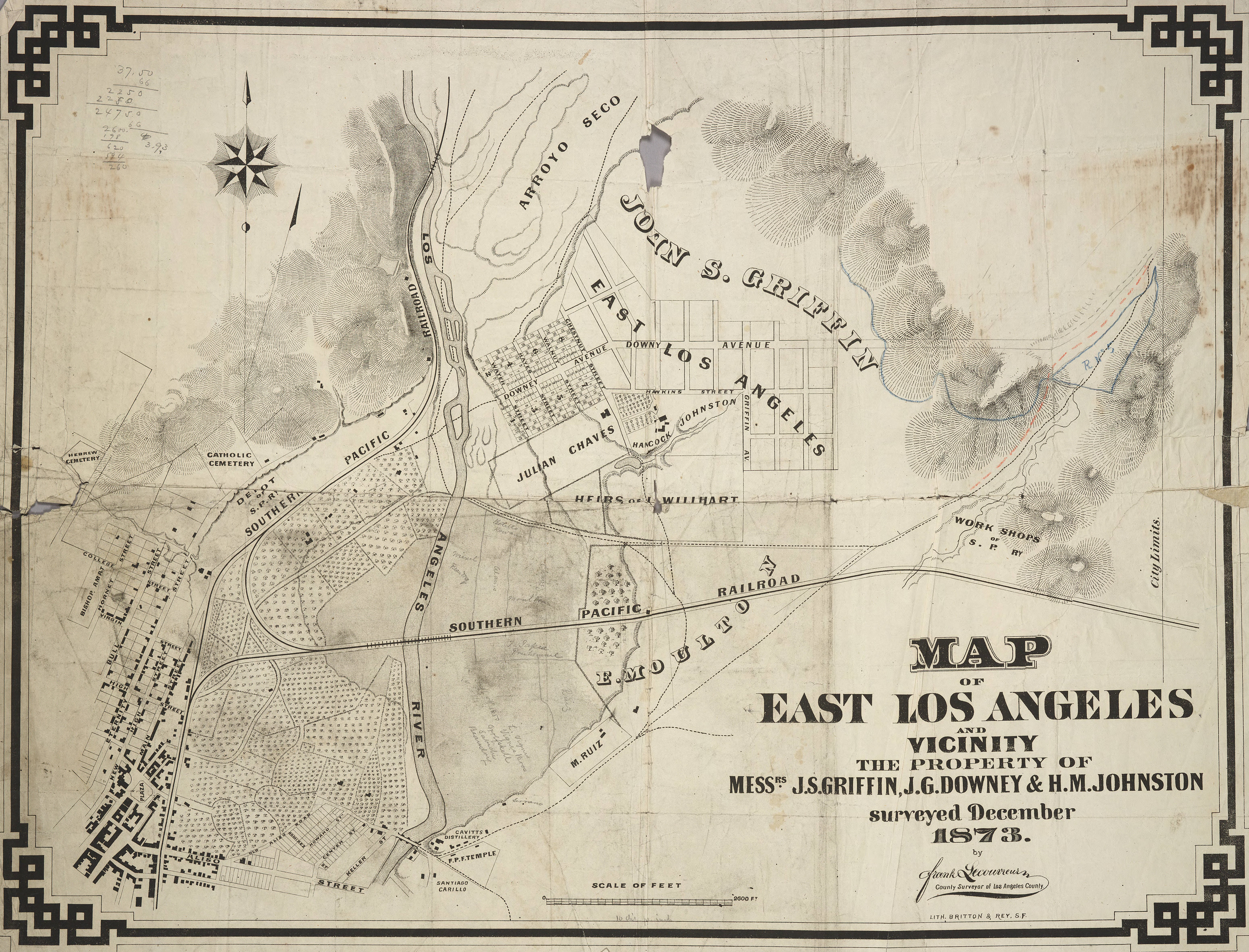
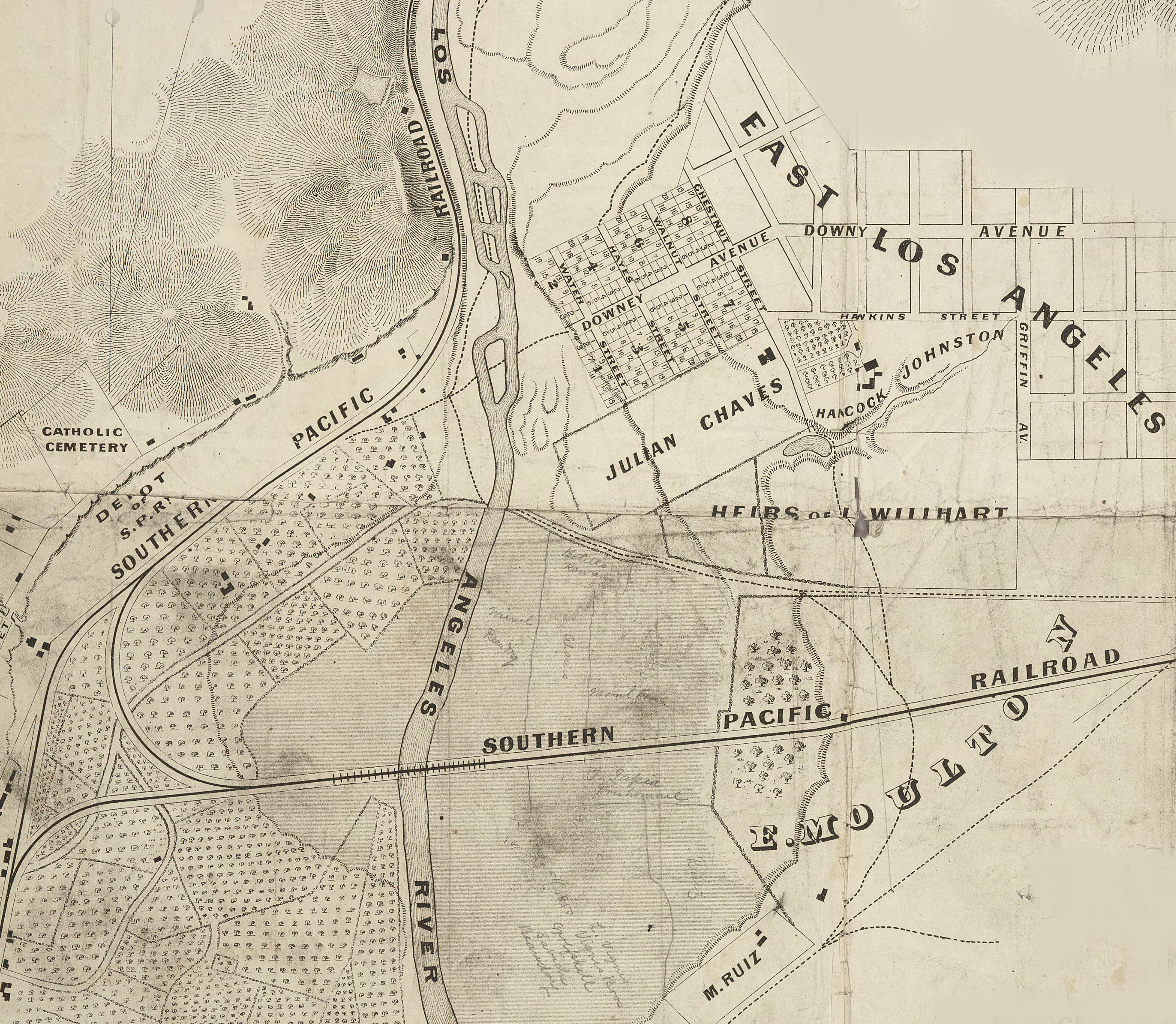
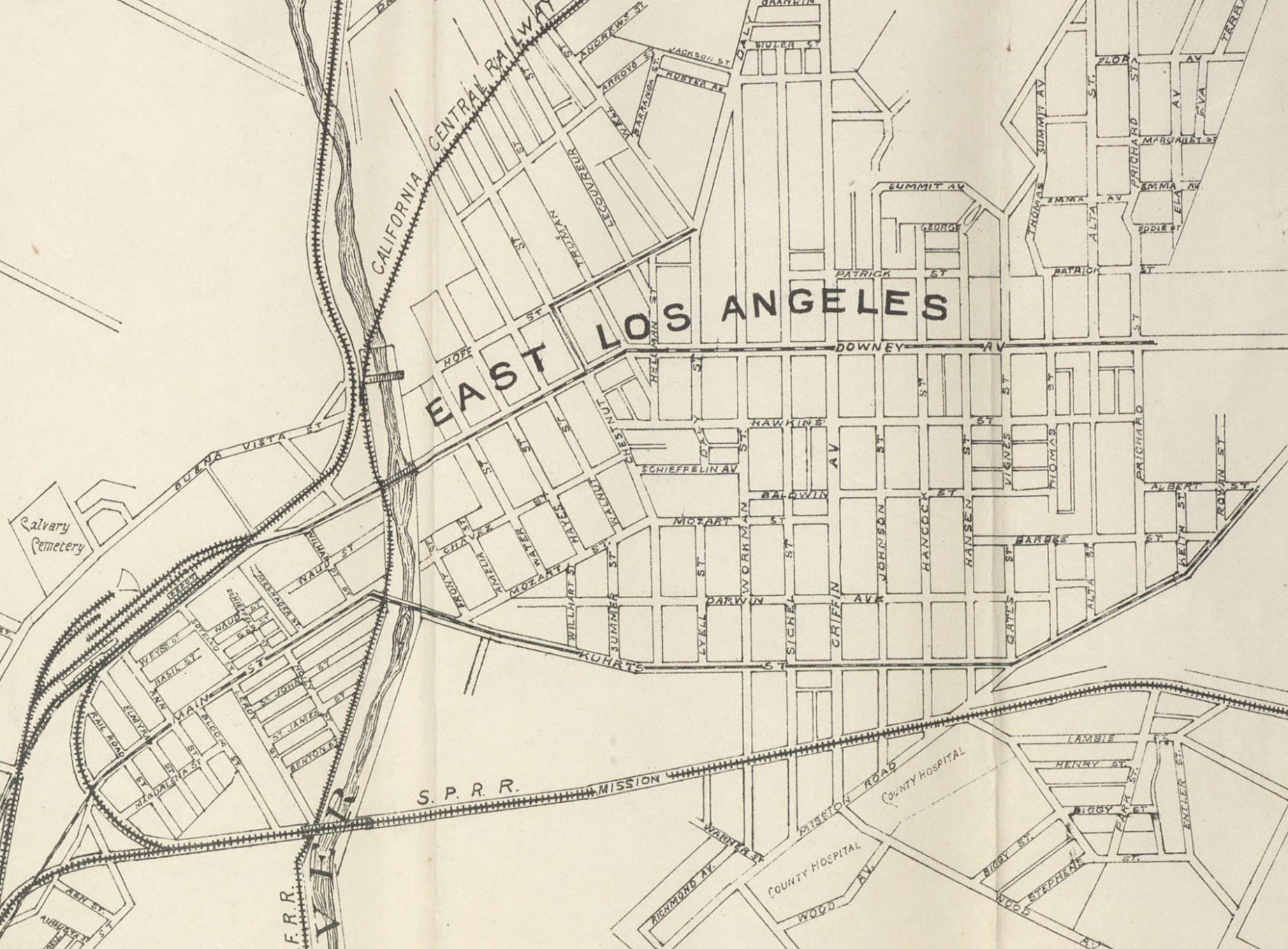
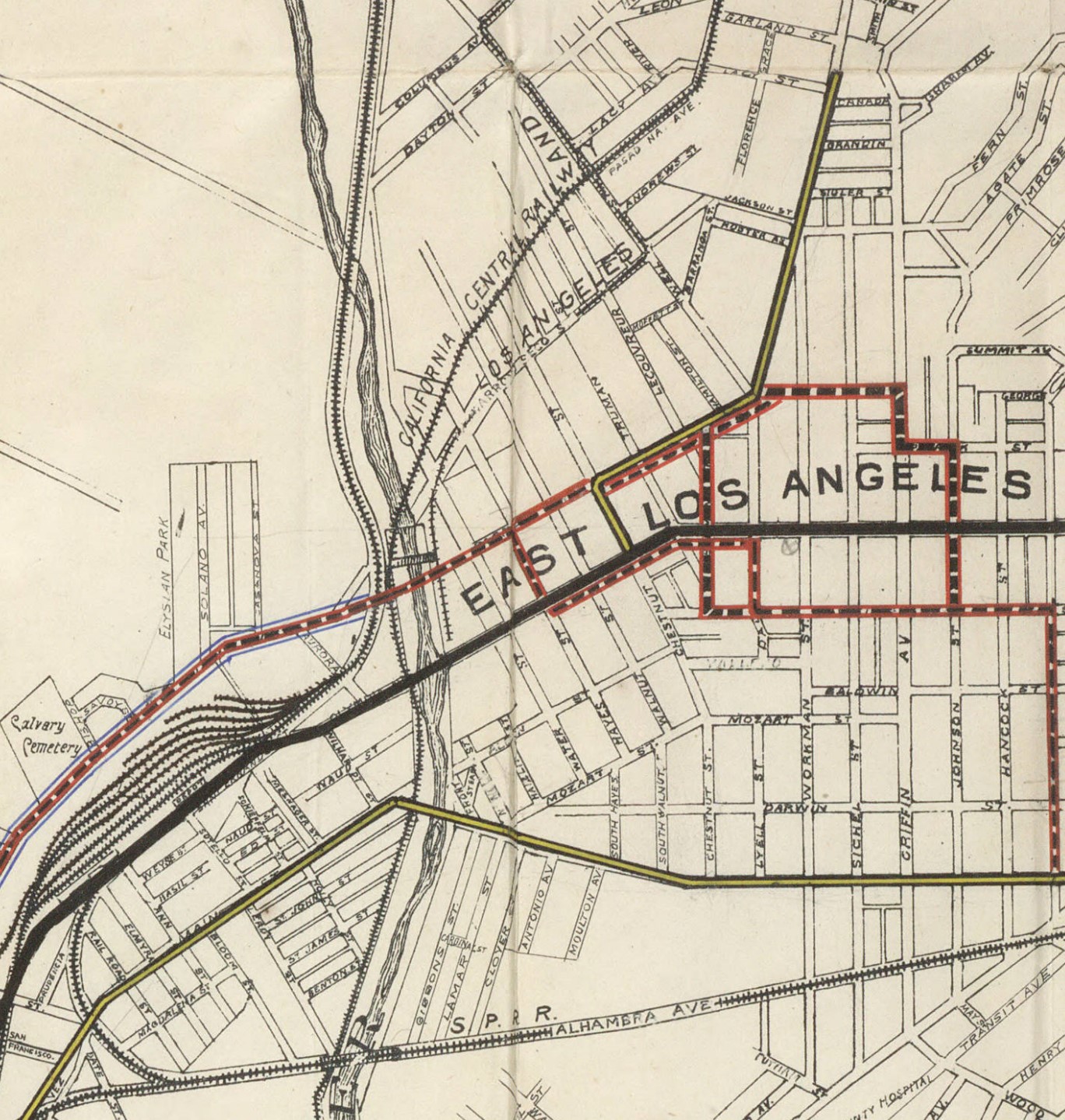
Map of East Los Angeles, showing the plot of land previously owned by Don Luis Vignés — 1873
-Images courtesy of the Huntington Digital Library, Huntington Rare Book Maps, “Map of East Los Angeles and Vicinity the Property of Messrs. J. S. Griffin, J. G. Downey & H. M. Johnston,” by Frank Lecouvreur, County Surveyor of Los Angeles County, surveyed December 1873
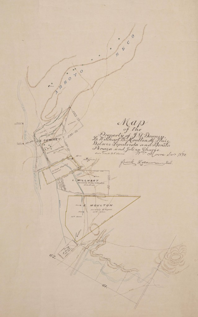
Map of the Property of J. G. Downey, L. Willhart, E. Moulton, M. Ruiz, Dolores Sepulveda and Benita Peraza and Julian Chavis — 1874
-Image courtesy of the Huntington Digital Library, Huntington Rare Book Maps, “Property of J. G. Downey, L. Willhart, E. Moulton, M. Ruiz, Dolores Sepulveda and Benita Peraza and Julian Chavis,” by Frank Lecouvreur, County Surveyor of Los Angeles County, 1874
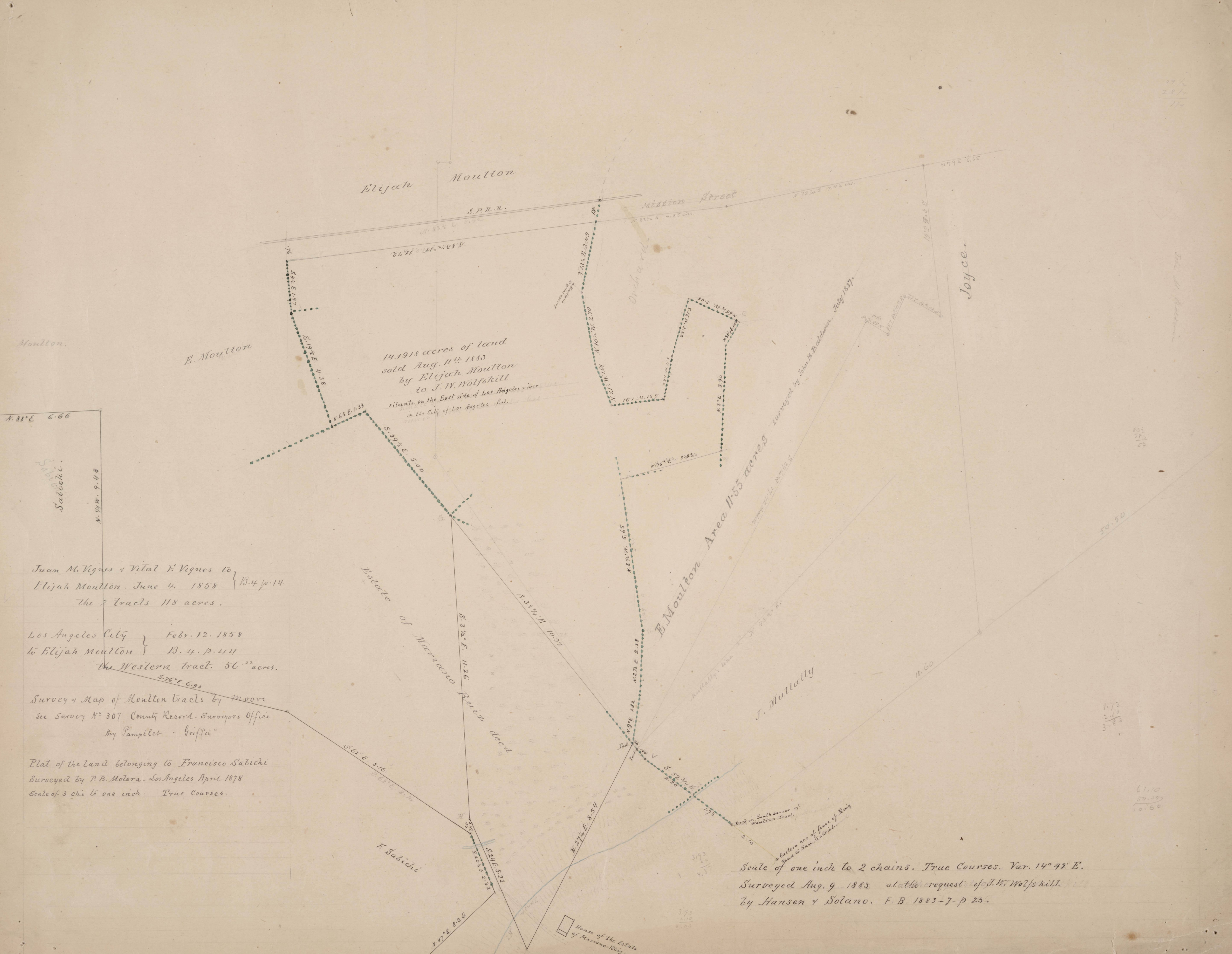
Moulton Tracts east of Los Angeles River — 1883
-Image courtesy of the Huntington Digital Library, Solano-Reeve collection, “Moulton Tracts east of Los Angeles River,” by Hanen & Solano, August 9, 1883
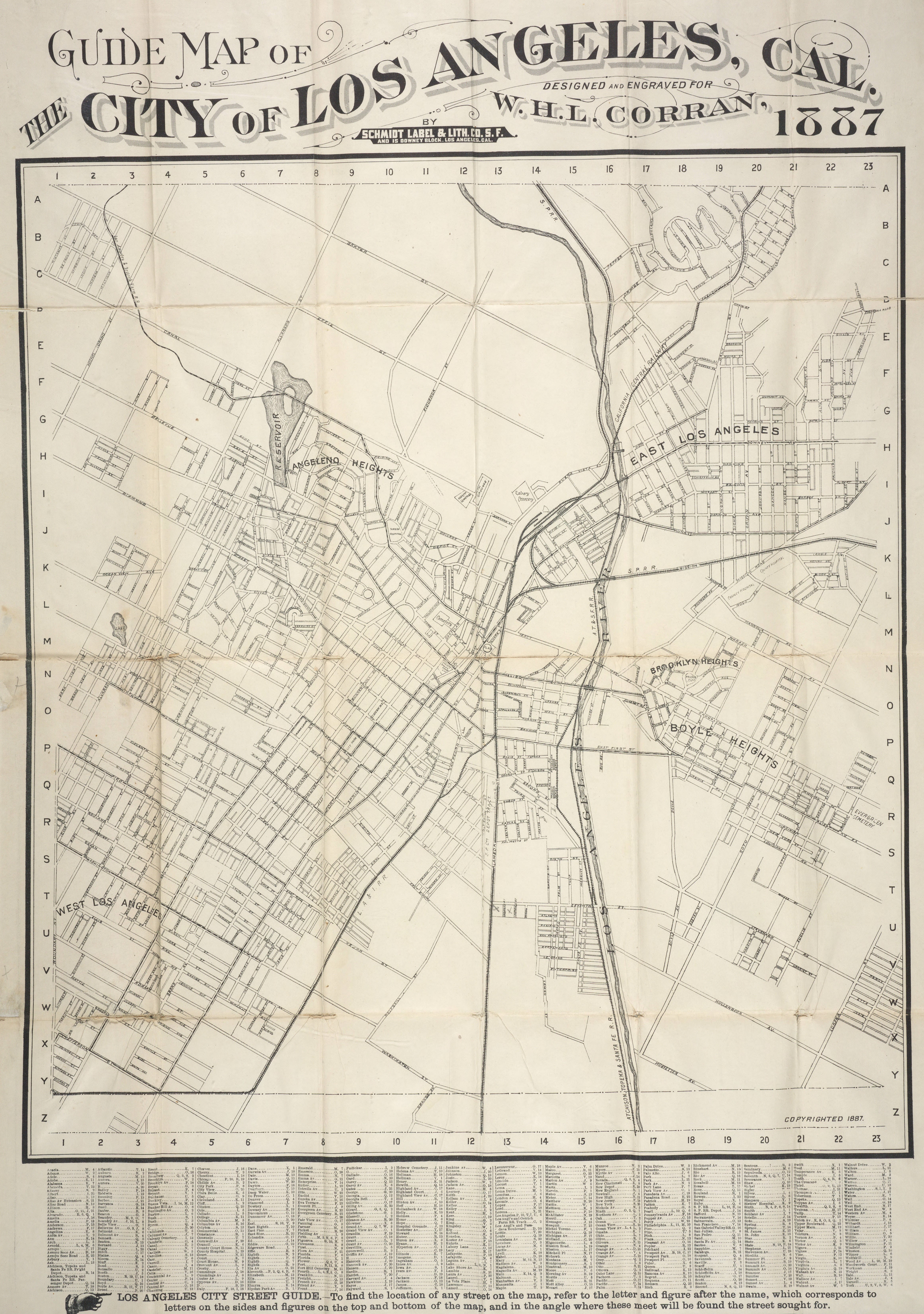
Guide Map of the City of Los Angeles, Cal. — 1887
-Images courtesy of Huntington Digital Library, Huntington Rare Book Maps, “Guide Map of the City of Los Angeles, Cal.,” by W. H. L. Corran, Schmidt Label & Lith. Co., San Francisco, 1887
“Baxter St. to the north, Hoover St. to the west, Lorena St. to the east, Jefferson to the south. Compare this map with… the same map printed four years later. Considerable development occurs during that period including additional public transportation lines. Printing process: lithography by Schmidt Label & Lith. Co., 21-31 Main St. S. F. and 15 Downey Block, Los Angeles, Cal. Copyright 1887.” -Excerpt courtesy of the Huntington Digital Library, Huntington Rare Book Maps, “Guide Map of the City of Los Angeles, Cal.,” by W. H. L. Corran, Schmidt Label & Lith. Co., San Francisco, 1887. (top) Image courtesy of the Huntington Digital Library, Huntington Rare Book Maps, “Map of East Los Angeles and Vicinity the Property of Messrs. J. S. Griffin, J. G. Downey & H. M. Johnston,” by Frank Lecouvreur, County Surveyor of Los Angeles County, surveyed December 1873
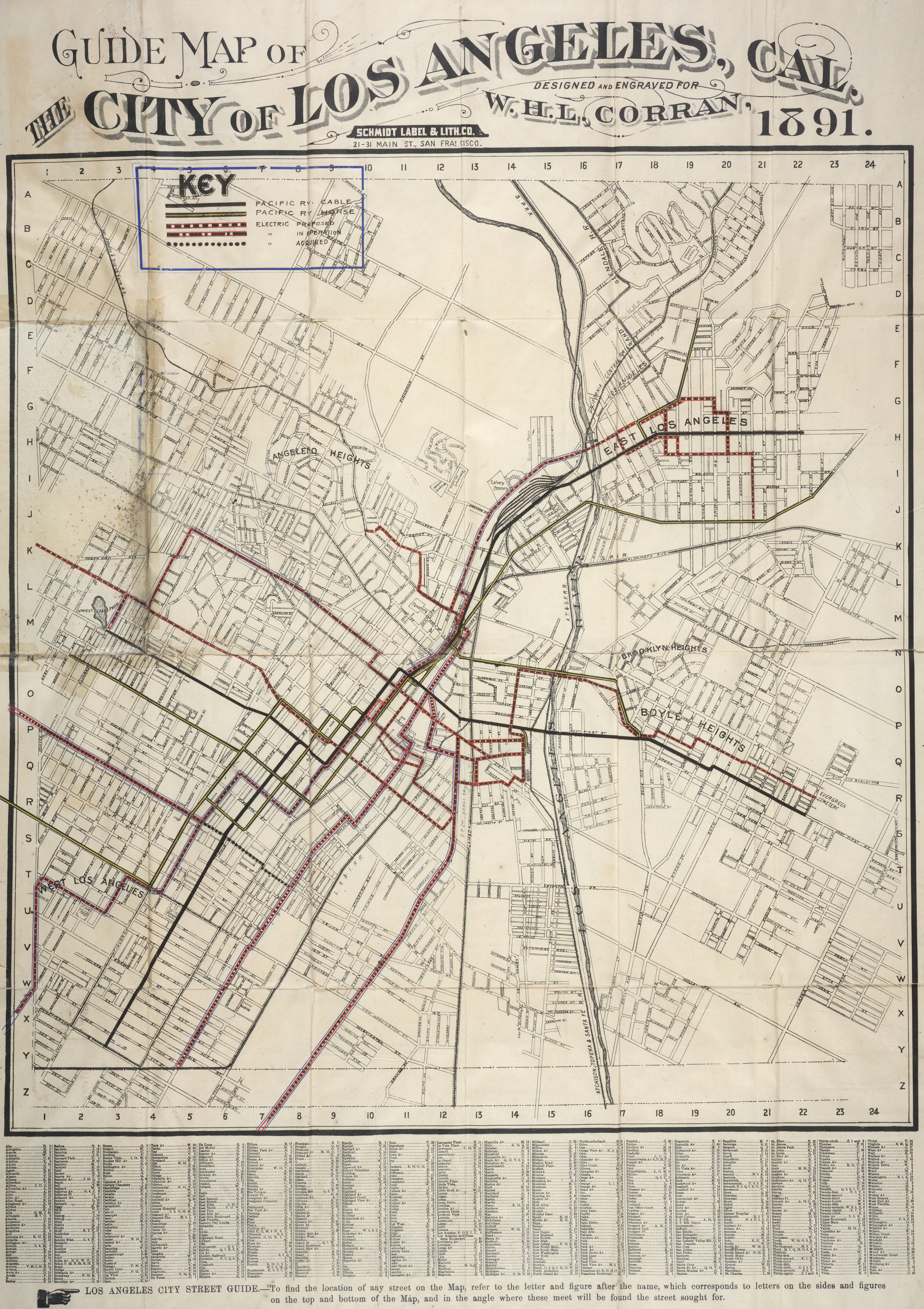
Guide Map of the City of Los Angeles, Cal. — 1891
-Images courtesy of Huntington Digital Library, Huntington Rare Book Maps, “Guide Map of the City of Los Angeles, Cal.,” by W. H. L. Corran, Schmidt Label & Lith. Co., San Francisco, 1891
Roger Sherman, also of Connecticut, was known to have given one of the shortest speeches in history at a bridge dedication ceremony when he said, "I think it will hold up all right," while testing the strength of the bridge with one foot.
View all posts by Arthur Mullen